Distance :
6.86km
Signpost
Loop :
Yes
Difficulty :
Easy
Duration :
2h 10
Elevation gain :
203m
Elevation loss :
209m
Starting point :
49.87233539948158,5.8046744
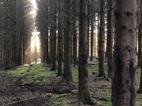
Description
Trail created by Ministère de l´Économie.
Website: https://map.geoportail.lu/theme/tourisme?fid=176_3541016
Website: https://map.geoportail.lu/theme/tourisme?fid=176_3541016
Ardennes-étape Privilege
Loading...
With your reservation, you automatically receive one month of Premium access to SityTrail, a GPS app that allows you to discover lots of great trails near your holiday home!
How do you activate your free access to SityTrail?
- Go to your customer account, Benefits section
- Click the link to create your account on the SityTrail website
- Download the app
- Explore the Ardennes!
Altimetric profile
Explore the surroundings
9.4
Reviews
à.p.d
955.00€
Bastogne
-
21km away
9.2
Reviews
à.p.d
356.00€
Vaux-sur-Sûre
-
15km away
9.2
Reviews
à.p.d
1,188.00€
Vaux-sur-Sûre
-
19km away
9.4
Reviews
à.p.d
688.00€
Libramont
-
29km away
9.4
Reviews
à.p.d
1,261.00€
Sainte-Ode
-
21km away
/Holiday-cottage-107405-01/Fiche_G-Holiday-homes-107405-01-Wiltz-(LUX)-1489868-1L.jpg)
9.4
Reviews
à.p.d
818.00€
Wiltz (LUX)
-
4km away